College Students’ Innovative Entrepreneurial Training Plan Program
Junming Wang, Hamzah Al-Neshmi, Dan Yang, Zhilu Zhao, Jintao Wei
(National Level- ¥ 10000 RMB)
System Features:
- Accuracy up to millimeter level
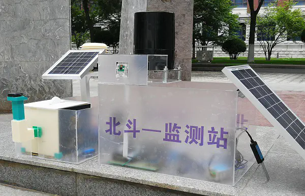
The Beidou satellite navigation and positioning system has the highest certification accuracy in the industry, and the whole system has strong multi-frequency anti-interference ability, which can realize high-precision monitoring of the three-dimensional deformation of the surface of the geological disaster point.
- Support multi-mode communication
It supports multiple communication methods such as GPRS/Beidou short message/4G/LoRa/NB-lot, and the real-time information transmission is strong.
- Ultra-low-power design
Integrated design, low power consumption, support for years of maintenance-free operation, stable performance, easy installation, complete monitoring.
- Remote device management
Really realize the remote interconnection of equipment, remote management of equipment and system upgrades can be realized with the help of the platform, and mobile client login system is also supported , so that data and alarm information can be conveniently and quickly viewed anytime, anywhere
- High system reliability
In response to different disaster forms, the effective selection and matching of sensors, while actively responding to national policies, realize the promotion of universal monitoring equipment, which not only achieves cost control , but also ensures the stability and reliability of the system for a long time.
- Autonomous platform service
The team independently builds a big data platform service architecture, uses cloud services to distribute, process, balance, manage and analyze data in real-time, and uses the web to interact with data, conduct professional model analysis for each monitoring point, and start based on the results of data fusion To the early warning and scheduling role